BUILDING OUTLINES
How The Building Outlines are derived
Below is how the shapes of buildings, road outlines and other major landmarks are created using Satellite images bought from ikonos annually.
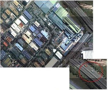 The 1m satellite image is detailed enough
to highlight even road markings and cars on the road |
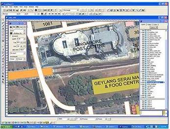
1m Satellite Image
This is a sample of satellite image used by our Map Makers to draw the outlines of buildings, MRT Stations including major roads and expressways in Singapore. |
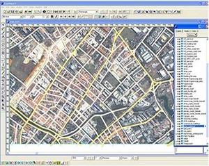 |
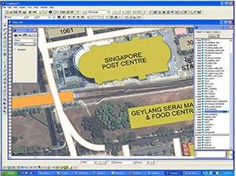
From the satellite images, our cartography team are able to trace out the major roads. |
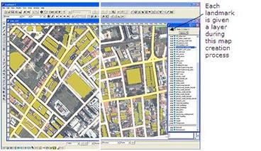 |
Once the major roads are traced, our cartography team will be able to then trace out the outlines of buildings, MRT Stations and all other major landmarks that are visible from the satellite images. |
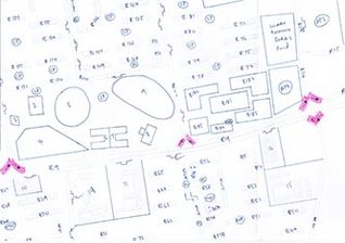 |
On The Ground Surveys Once the outlines are captured, the maps are given to surveyors who will obtained the building names, building addresses and X,Y (lat/long coordinates) and other landmark attributes through ground surveys. Every single map has to be covered to capture and validate the satellite data to ensure that the data captured is correct! |
 |
Once all the data and all other attributes are captured, the maps are sent back to QC team who will verify the accuracy of the data (check for errors) before passing it to : a. Cartography team to have the proper names and terms entered onto the maps. b. Database team who will add artificial intelligence (AI) to the attributes before entering them into the database. AI will allow users to search for the data faster. |
 |
Colours are also added. |
